The popular New Zealand Energy Infrastructure Map is now two separate maps, one for each island.
Our range of industry infomaps are very popular and seen throughout New Zealand. They cover the energy and resources sectors and provide a visual geospatial overlay of many of the datasets we have available on the Energy News and Inside Resources websites.
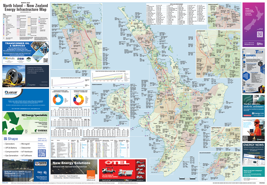
The popular New Zealand Energy Infrastructure Map is now two separate maps, one for each island.
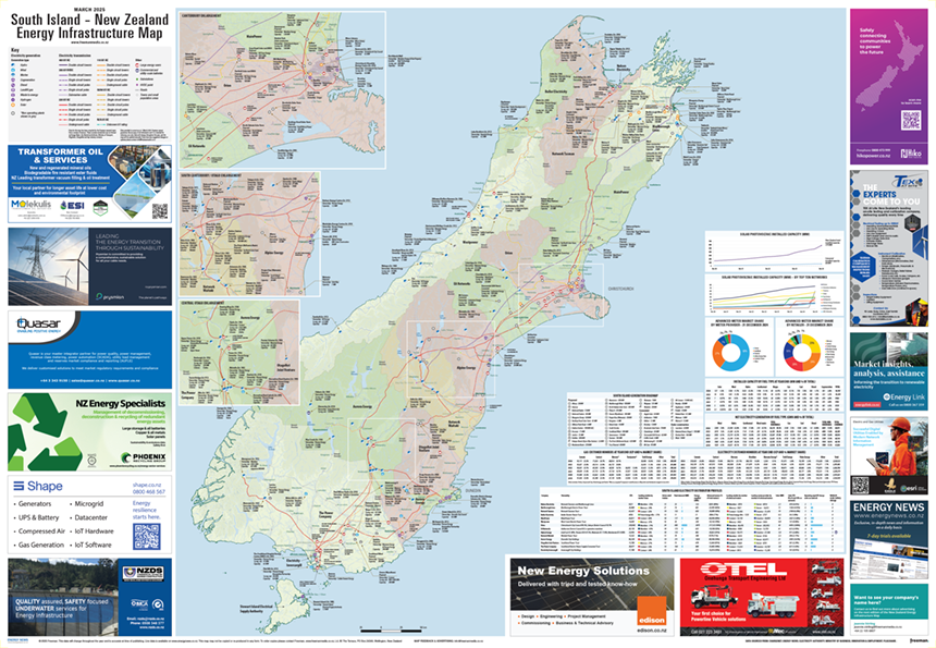
The popular New Zealand Energy Infrastructure Map is now two separate maps, one for each island.
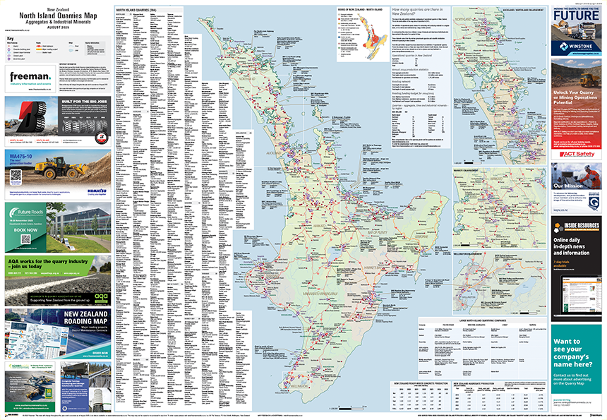
The New Zealand Quarry Maps are designed to give an insightful and comprehensive snapshot of the local quarrying sector.
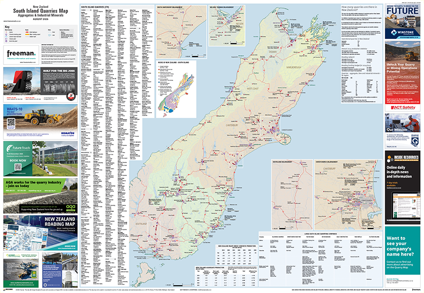
The New Zealand Quarry Maps are designed to give an insightful and comprehensive snapshot of the local quarrying sector.
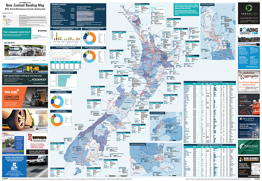
The New Zealand Roading Map collates important District Maintenance and Network Outcomes contract data, as well as other key roading stats, into one information source.